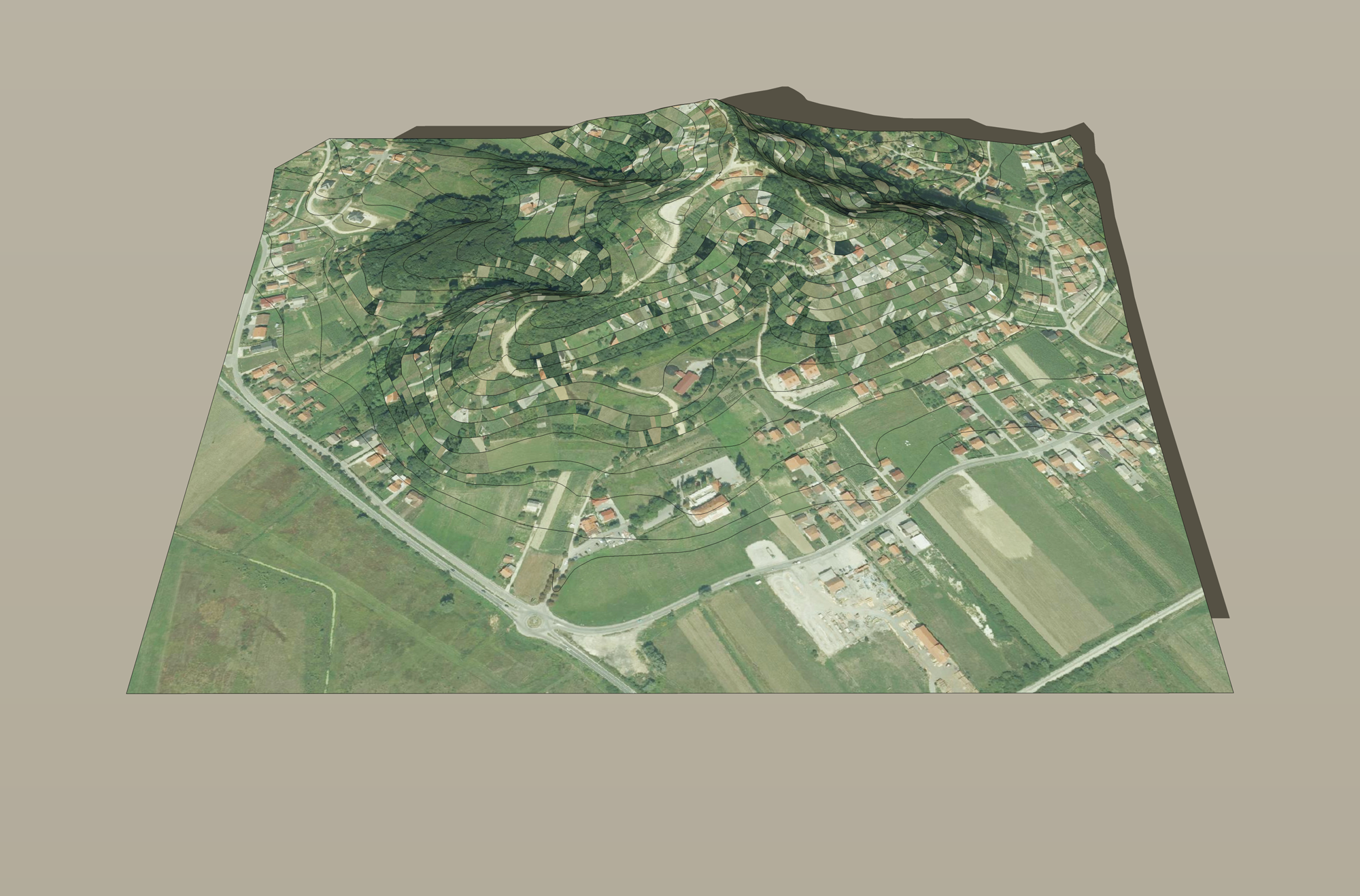
TERRAIN
A natural terrain is called a topographical surface.
In the elevated topographical this surface depicted with horizontals, as same as the plane, i.e. with lines that have same elevation.
For the horizontal with the elevation 0 of a topographical surface it is usual to take the sea level.
The depiction of a topographical surface in program Rhino
A topographical surface will be always given on a template with its horizontals.
When making a model of a topographical surface (terrain) in program Rhino we will put its lowest horizontal at the elevation 10.
EXAMPLE
The topographical surface is given on the following template. Make a model of the terrain in program Rhino.
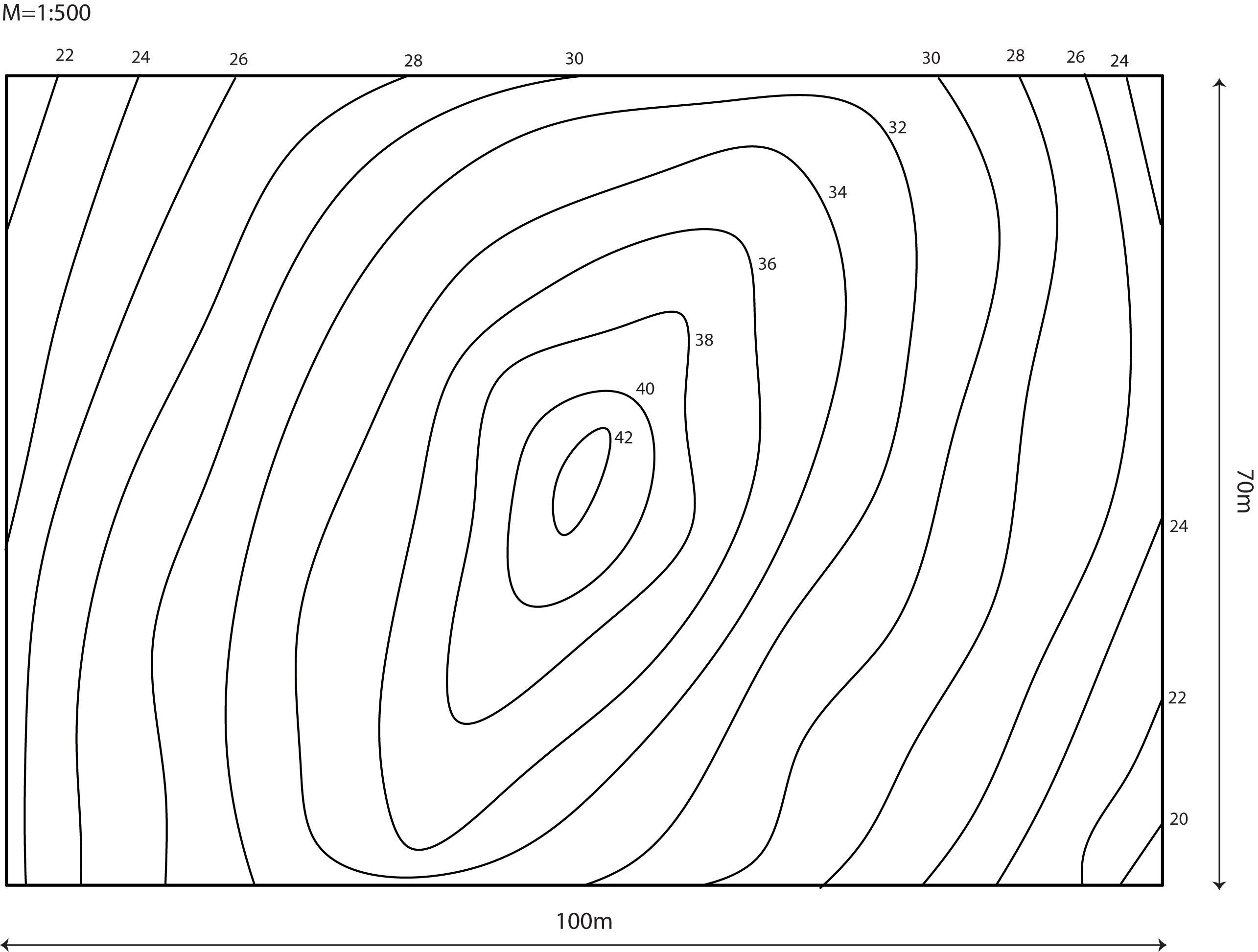
 construction of the horizontals and making a model of the topographical surface
Created by Sonja Gorjanc, translated by Helena Halas and Iva Kodrnja - 3DGeomTeh - Developing project of the University of Zagreb